
Project Overview
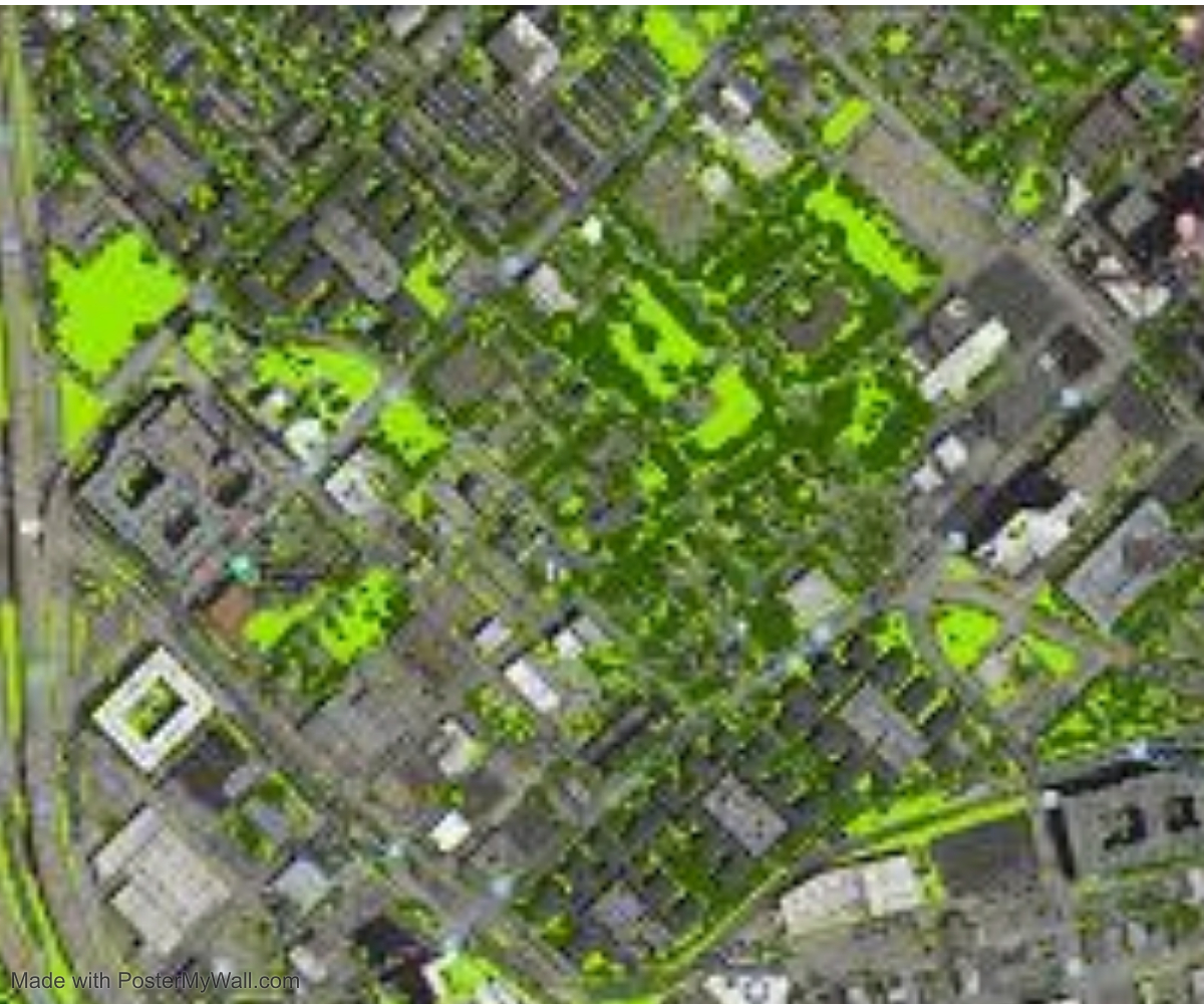
Our company is highly concerned with helping government and private sectors to enhance their productivity and efficiency through GIS and remote sensing mapping. The main customers include Ministry of Natural resources and tourism, Ministry of energy and minerals, Ministry of water, Ministry of agriculture, Ministry of works and Ministry of information, communication and information technology. Our task is to map all resources including land and property, and create database systems for easy management of information. We help in tourism, water resources, conservation and management of game reserves and national parks, agriculture planning and mapping, telecommunication mapping and planning services etc. Though GIS and remote sensing, we can integrate geophysical, geotechnical and geological data to help in understanding natural hazards occurrences, mineral discoveries, surface and subsurface mapping, designing and improving construction codes, areas prone to floods, areas prone to seismic hazards, areas prone to volcanoes and other natural processes. We are experts in identifying presence of Oil and gas and other minerals. Other services include preparation of land cover maps classified for various analysis and land use plans preparation for better resources management.
Project Planning
Dedicated Team & Plan With a long and given to environment slightly design planning.
Satisfied Service
Dedicated Team & Plan With a long and given to environment slightly design planning.
Dedicated Team
Dedicated Team & Plan With a long and given to environment slightly design planning.